MAHABALESHWER

Overview


MAHABALESHWER is a small town and a municipal council in Data district in the Indian state of Maharashtra. It is a place of pilgrimage for Hindus because the Krishna river has its origin here. The British colonial rulers developed the town as a hill station and served as the summer Capital of Bombay Presidency during the British Raj.

  • Elevation:- 1,353m (4439ft)
  • Area:- 137.2km sq
  • Sex ratio:- 90 females/ 100males
  • District:- Satara
  • Population:- 12,737 (2011)

Geography


Mahabaleshwer is located at 17.9237°N 73.6586°E. It has an elevation of 1,353 meters (4439ft). Located about 120km (75mi) southwest of Pune and 285km (177mi) from Mumbai, Mahabaleshwer is a vast plateau measuring 150km (58sqmi) bound by valleys on all sides. It reaches a height of 1,439m (4,721ft) at its heighest peak above sea level, known as Wilson/Sunrise point. Mahabaleshwer comprises three villages : Malcolm peth, Old “Kshetra” Mahabaleshwer and part of the Sindhola village. Mahabaleshwer is the source of Krishna River that flows across Maharashtra, Karnataka, Telangana, and Andhra Pradesh. The legendary source of the river is a spout from the mouth of a statue of a cow in the ancient Temple of Mahadev in Old Mahabaleshwer.

History


On the outskirts of Mahabaleshwer, towards Panchgani. The first historical mention of Mahabaleshwer dates back to year 1215 when the King Singhan of Deogiri visited Old Mahabaleshwer. He built a small temple and water tank at the source of Krishna river. Around 1350 a Brahmin dynasty ruled this area. In the middle of the 16th century the Maratha Family of Chandarao More defeated the Brahmin dynasty and became rulers of Javli and Mahabaleshwer, during which Old Mahabaleshwer temple was rebuilt.

In 1656, the founder of Maratha empire Chhatrapati Shivaji Maharaj under controversial circumstances, killed Chandrarao More, a fellow Maratha feudatory of Bijapur, and seized the valley of Javali, near Mahabaleshwer, from him. Around that time Chhatrapati Shivaji Maharaj also built a fort near Mahabaleshwer called PratapGad. The fort remains in the hands of Shivaji’s Descendants to this day.

Transport

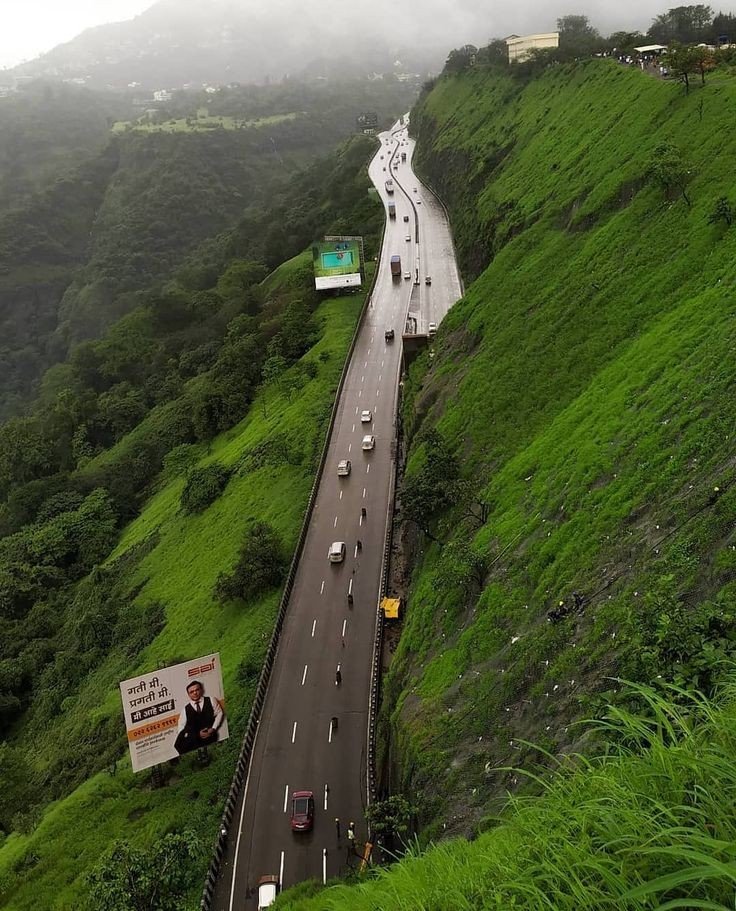
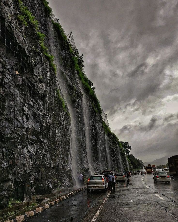
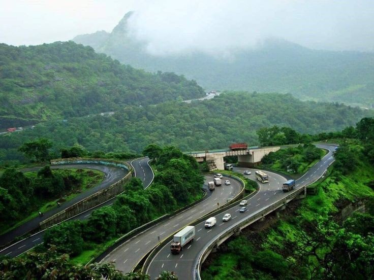
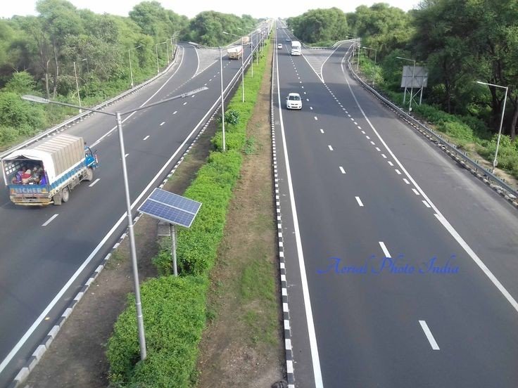
By Road:- Mahabaleshwer is 32km from Wai. It is 260km from Mumbai, the state capital. The nearest major city in Satara is 45km and it is 120km from Pune. Mahabaleshwer is connected by the National Highway 4. Bus services by State-run MSRTC and Private organizations connect it to Pune, Mumbai, Sangli and Satara.

Rail

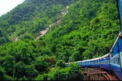
Nearest railroad is Satara 60km, nearby major railway junctions include Pune (120km), and Niraj (170km). State run bus services are available in these locations to Mahabaleshwer. Railway station Diwan Kharvati on Konkan Railway near Khed gives route of 60km via Poladpur to Mahabaleshwer.

Airway

The nearest Airport is Pune international Airport, serving the city of Pune, 120km from Mahabaleshwer.

Sunset at Mahabaleshwer
Lake near Mahabaleshwer

Places to visit

  1. Mahabaleshwer Temple:- Panchaganga temple in Old Mahabaleshwer 1850s. In old Mahabaleshwer 7km from Mahabaleshwer there are many tourists point and 5 temples to see, with examples of old Indian Architecture. There are also natural view points, some of them named by the 19th century British colonial rulers.
  2. Krishnabai temple:- Behind Panchaganga temple, there is a small trail that leads to Krishna Bai temple where the Krishna river is worshipped. It is built on the hilltop overlooking the Krishna valley and was built in 1888 by a ruler of Ratnagiri on the Konkan coast. The temple has a Shiva Lingam and a beautiful statue of Krishna. A small stream of the river flowing from the cow-face (Gomukh) falls on a Kinda or water tank. Stone carved columns and ceilings are the special characteristics of this Temple. This old temple has gathered moss and is in ruins. It is not visited much by tourists and is isolated. But it provides a most exquisite view of the river Krishna.
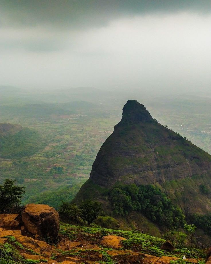
  3. Monkey Point:- Named because of the natural sculpture of the stones which looks like three Monkeys sitting beside each other and portraying 3 monkeys of Gandhiji. Nestled deep in the Valley one can figure out from the outline of a big stone a natural cut out it give an effect of 3 Monkey sitting next to each other portraying the Three Wise Monkeys. They point is on route to Arthur’s Seat.
  4. Arthur Lake:- This geographical point is named after Officer Sir Arthur Market (1806-1888) who frequented the spot to gaze at the Savitri River, where he lost his wife and children in a tragic ferry mishap.
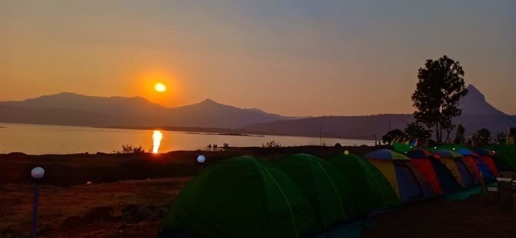
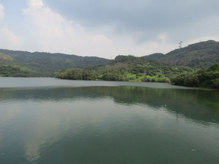
  5. Vienna Lake:- Mahabaleshwer is Holiday place, Honeymoon spot and a pilgrimage site for people. Boats on the Venna lake in Mahabaleshwer. The Venna lake is one of the tourist attractions of Mahabaleshwer. The lake is surrounded by trees. There are Hotels from budget hotels to 3 star. Some Hotels are also near Lakes view or in the market.
  6. Kate Point:- It is located to the east of Mahabaleshwer and is famous for its view of two reservoirs, balakwadi and Dhom. The point is around 1280m high.
  7. Needle Holepoint/ Elephant point:- Needle hole point is located near Kate’s point. One can see a natural rock formation with a hole in between, thus given the name Needle hole. The point is also famous for the view of Deccan traps, which look like an elephant’s trunk.
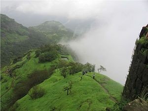
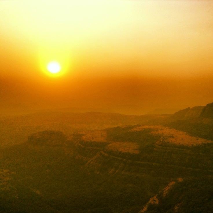
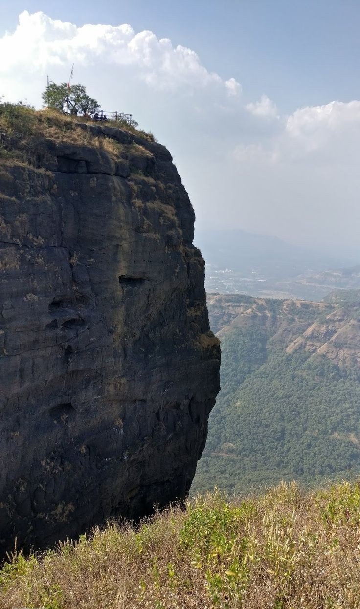
  8. Wilson point:- Named after Sir Leslie Wilson, the Governor of Bombay from 1923 to 1926. Wilson Point is the highest point in Mahabaleshwer at 1439m. Known as Sindola Hill during the colonial rule, Wilson point is the only location in Mahabaleshwer where both sunrise and sunset can be seen. It offers a spectacular glance of Mahabaleshwer in all directions. It is located behind the Mahabaleshwer-Medha road at 1.5km from Mahabaleshwer city.
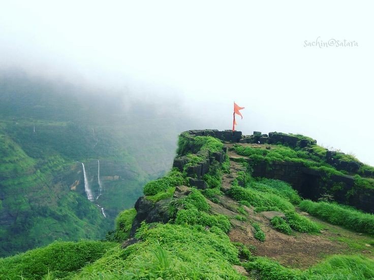
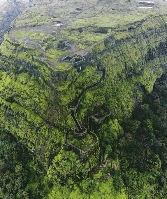
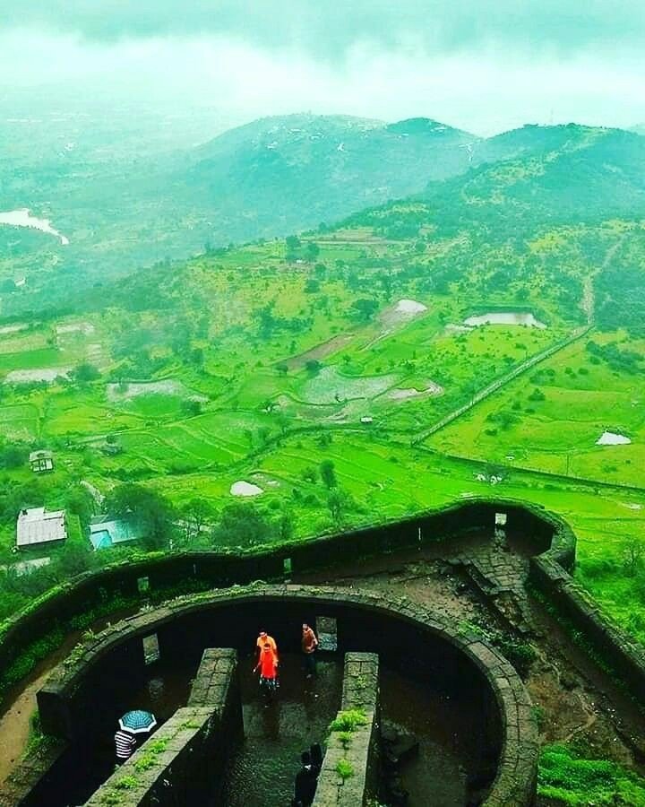
  9. PratapGad:- it is a fort near Mahabaleshwer built by Chhatrapati Shivaji Maharaj. It is the site of the encounter between Shivaji and Bijapur general. Afzal khan where the latter was defeated and killed by Chhatrapati Shivaji Maharaj.
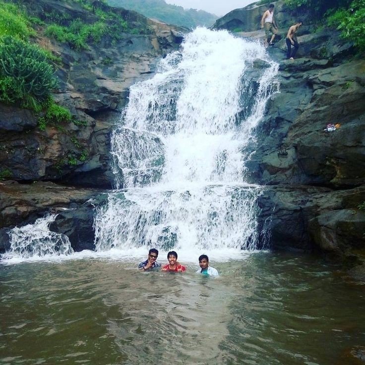
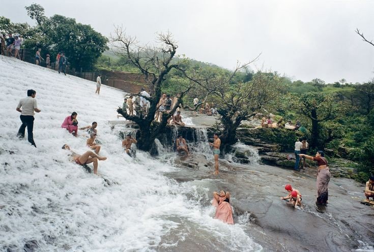
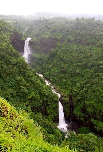
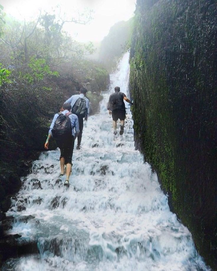
  10. Lingmala waterfall:- This waterfalls is located near Mahabaleshwer. The water here falls from the height of approximately 600 feet. The water of Lingamala waterfalls cascades into the Venna Lake. The waterfalls are divided by outward projecting rocks into multiples tiers.
KRISHNABAI temple
PratapGad fort
Lingmala waterfall
Elephant point
Monkey point
Strawberry

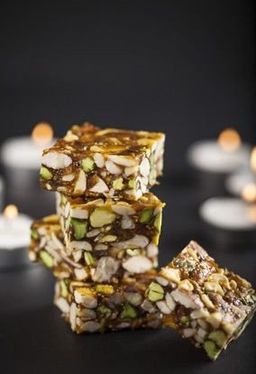
Also famous for the berry Climate of the area is suitable for cultivation of strawberries, this place contributes to about 85% of the total production in the country. It also received the geographical indicator tag in 2010 Strawberry is personally my favourite fruit.
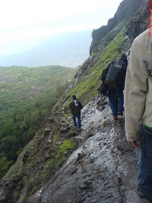
If you like my blog please like comment share and Follow

ROAD TRIP TO MATHERAN

That’s me

The only best way to Travel on the hill stations is by road, there’s no other way that can be equally compared advising with my personal experience.

How to reach:- If you leave in Mumbai it take 2hr to reach at top of the mountain place which is around 95km long from my place, roads are simple and easy the best way to take help is of Google map but if you are frequent traveller like me then there would be no difficulty, petrol will cost you around 500rs for bike and for car it could be around 1000rs.

Other than roadway is railway, Neral is the closest railway station to Matheran. Situated to Mumbai-Pune line it is just 21km away from Matheran you can also board the Matheran hill railway from Neral which is one of the 6 mountain railways in India, nearest airport to Matheran is Pune, one can also take a cab or a bus from nearby towns to a place close to Matheran (3km) and take horse-rides or walk or Man pulled rickshaws to reach our destination.(Automobiles are not allowed in Matheran and hence one has to use these pollution free methods.

Matheran Toy train

NOTE: I would not recommend to take horse rides because that’s animal abuse, Make sure before leaving for the journey Kindly Check your vehicle condition like Engine oil, break oil, Clutch wire, break wire, horn and Tyres air pressure.

My Ride

PLaces explored during ride

One of the reasons to choose road trip is that you will love to watch the beautiful nature side by side while you travel, unimaginable places can be explored fortunately which happens mostly with me, during my trip as I traveled many times in that journey many pictures have be clicked. It’s feels amazing to see such things in real life as compared to reel life

Places of Attraction

  • Louisa point:- Louisa point is one of the most famous viewpoints in Matheran, it offers two different views from the top, visit Louisa point is on a clear day to enjoy the spectacular view of the city and the remains of Prabal and Vishalgad fort, the best time to visit is during sunset, it is located 1.5km away from the main market area and is easily reachable on foot. Tips:- Beware of Monkeys, do not carry any food items as they might try to snatch it, do not support animal abuse like horse rides.
Louisa point
  • Charlotte Lake:- Also known as Sharlott lake, It is one of the most spectacular attractions of Matheran, it is an ideal quick retreat for those who seek silence in the lap of nature and a perfect spot for the Campers and picnickers. Set amidst a densely populated forest, birdwatching is a popular activity here. People visit here for sunrise and sunset view of Echo point. Tips:- Since the lake serves as a source of drinking water for Matheran don’t try to take bath or wash anything in the lake it is forbidden and also beware of Monkeys and their snatchings.
Small part of lake

Trekking routes:- Matheran has various trekking routes. All routes are easy from climbing difficulty point of view.

  • Sunset point is the route from Dodhani village to Sunset point. This is the most popular route for trekkers. Dodhani village is about 45 minutes by State Transport bus from Panvel.
  • Garbett point Route is the route that starts from Sagachiwadi a small tribal village near to Dhom dam. Garbett point is the least visited point in Matheran because it is very far away from market compared to other points. Mostly there is always no one at Garbett point even during peak season. The vast green stretch of Garbett plateau is major attractions during Monsoon season.
  • Rambaug Point Route is a small and popular point near One tree hill point. This route goes from Rambaug point to a small village called Pokharwadi near Chowk village. The route passes through a waterfall during rainy season.
  • One tree hill this route starts from Ambewadi village. Ambewadi is near Pokharwadi village, where route starts from Rambaug point. There is a view of Morbe Dams backwater while going through Rambaug and One Tree hill route.
  • Vikatgad route is the most difficult one. This route to Garbett point is the next more popular route. All the routes require 2-3 hrs climb to reach Matheran. The route of Rambaug point and One Tree Hill are usually not taken by any trekkers nowadays.

Food
After so much of long and hard way of trek body requires plenty of energy source. There are all kinds of restaurant in Matheran serving various cuisines. Most hotels offer packages including all meals. Try the Gujarati Thali. Or the Maharashtra style Vada-Pav (Indian burger) which is available at the various points. Also try Chikki which is available in different flavours.

Sleep During the peak season, when it is very busy, prices are often as high as four times the off season winter price. Be ready to shell out minimum of INR 2000 for modest Non-Ac double bed room on a weekend. As it is a popular weekend trip from Mumbai, mid week is less full so you should be able to negotiate better prices, and there are various hotels down the paths away from the central buildings. It’s always better to stay in hotels in the hotels in the Market as you can roam around there once it gets dark. In far off hotels you would get locked up in the room as it won’t be advisable to venture out in the dark in forest. Better don’t book any rooms from the agents who would surround you at Novel Station. There are many rooms( hotels, cottage and resorts) up at Matheran market and it is better to actually check the rooms and then deal directly with the owners as this can save money as well as disappointed if being dubbed into a poorly maintained sub standard room.

Below are few more information about Matheran

List of trees growing in Matheran

Albizzia chinensis (Udal, Kajav)


actinodaphne angustifolia (Pisa)


Sugran Tree


Chambel tree


Bambusa Vulgaris (kalak)

Wildlife:- The town has a large monkey population, including bonnet macaques and Hanuman langurs. Domesticated horses for riding are also in large numbers and are one of the symbols of Matheran. Inside the forest animals like barking deer, Malabar giant squirrel, fox, wild boar, mongoose may be found, but this animals are less in numbers as compared to Monkeys and usually do not venture where humans are present. There have been reports of leopard sighting in Matheran few times in last decades but due to dense forests in valleys surrounding Matheran leopards who are on the roam may climb Matheran, not a single report have been found of leopard attack in Matheran.

Leopard
Fox
Barking deer
Malabar giant squirrel
Mongoose
Wild boar

Thanks for watching and reading, if you liked my blog please Like comment share and follow

Lonavla the Hill Station

Introduction:- Lonavala is a hill station surrounded by green valleys in western India near Mumbai. .

Basic Info:-

Country:- India. State:- Maharashtra. District:- Pune. Area • Total 38 km (15 sq mi)

Mentioned below are some of beautiful pictures captured………..

Water fall
Lonavla Hill
Sunset view
Road in monsoon

Reaching at lonavla:- best way to travel is by road, admiring nature’s beauty through eyes is an mind-blowing experience.

eg: If the start point is from Mumbai, Andheri it will be around 110km till the hill point, road is clear and simple not very jerky and confusing. Average reaching time 2hrs 30min, which is quite nice.

Below are means of transport

By road
Lonavala is on the Mumbai-Pune Expressway and is well-connected to several towns of Khopoli, Karjat, Talegaon Dabhade, etc.

Mumbai Pune express highway

By train
Lonavla railway station
Lonavala is well-connected by train. Local trains run from Pune at 2-hour intervals. Those originating from Mumbai along the central line have Khopoli as their last station. Buses are available at regular intervals to complete the remaining 15 km of the journey to Lonavla from Khopoli bus station. It takes 2.5 hours by train from Mumbai and 1 to 1.5 hour from Pune. All trains, travelling between Mumbai and Pune, halt at Lonavala. Before the push-pull technology, trains from Mumbai used to halt at Karjat in Raigad District to attach banker locomotives before the train started the journey up the western ghats to reach Lonavala.

Train to Lonavla

By air
Lonavla does not have an airport, though the Indian Air Force station is situated on the way to Aamby Valley City. The city of Aamby Valley has its own private airport. The nearest commercial airports are Pune International Airport at 64 km and Chhatrapati Shivaji International Airport at 104 km. A seaplane service is also available between Juhu and Pawana Dam, which is 14 km away from Lonavala.

Place of Attraction

  • Bhushi Dam
  • Tiger point
  • Pawana Lake
  • Rajmachi Point
  • Rajmachi Fort
  • Sunil wax museum
  • Karla Caves
  • Lohagad Fort
  • Visapur Fort
  • Lion Point

Place Information with pictures

1. Bhushi Dam:- A waterfall near the dam is located between Lonavala and I.N.S. Shivaji. Buses running on the I.N.S. Shivaji Road stop here.

Bhushi Dam

2. Tiger Point:- Tiger’s Leap also known as Tiger’s Point is a cliff-top with a sheer drop of over 650 m, giving an extensive view. Buses are available up to INS Shivaji and the remaining distance of about 1.6 km has to be covered on foot. Legend has it that while being chased by a tiger once, the Maratha Empire king Shivaji jumped into a ditch on the hill and the tiger leaped off it into the valley giving it the name of tiger’s leap.

Tiger point

3. Pawna Lake:- Lake is surrounded by natural scenery, about 1.6 km from the town. The lake dries up during the winter and summer months offering an expanse of green grass which is used by walkers and joggers.

Pawna Lake

4. Rajmachi Point:- It is located about 6.5 km from Lonavala. This point commands a view of Shivaji maharaj’s fort, Rajmachi (Royal terrakouioce) and the surrounding valley. Regular State Transport buses ply between Rajmachi Point and Lonavala from the State Transport Bus Stand. The Vaghjai Dari is also located here.

Rajmachi Point

5. Rajmachi fort:- It is a historic fort close to Lonavala and attracts a lot of trekkers during the monsoon season. The fort also comprises two other forts – Shrivardhan Fort and Manaranjan Fort. Besides, the fort is known for the fireflies that lit up the surroundings in night.

Rajmachi fort

6. Lohagad fort:- A robust climb of about 11.2 km from Malavali railway station takes you to the ‘Iron Fort’, once a formidable battle-station of Shivaji. The fort commands a view of the surrounding hills and hamlets.

Lohagad fort (birdeye view)

Popular food

Lonavla chikki: It is a chikki, named after Lonavala a town in Pune district of Maharashtra India. Its genesis lay in a sweet called gud dani/ guddani/ gurdani made from jaggeryground nuts and ghee, sold by The Real Maganlal Agarwal from his sweet meat shop in Lonavala, this was packaged by railway authorities and sold to train travellers between Lonavala and Mumbai, encouraged by this Agarwal renamed gud dani “Maganlal Chikki” however it became and continues to be called Lonavala chikki.

Lonavla chikki

History of the place

Present day Lonavala was a part of the Yadava dynasty. Later, the Mughals realized the strategic importance of the region and kept the region for an extended time. The forts in the region and the “Mavala” warriors played an important role in the history of the Maratha Empire and that of the Peshwas. In 1871, the Lonavala and Khandala hill stations were discovered by Lord Elphinstone, who was the Governor of Bombay Presidency at the time.

Tourism

Lonavala and the adjacent Khandala are twin hill stations 622 metres (2,041 ft) meters above sea level, in the Sahyadri ranges that demarcate the Deccan Plateau and the Konkan coast. The hill stations sprawl over an approximate area of 38 square kilometres (15 sq mi). Tourism peaks during the monsoon season. The name Lonavala is derived from the words ‘leni‘ which means caves and ‘avali‘ which means series. i.e. ‘a series of Caves’ which is a reference to the many caves like Karla CavesBhaja Caves and Bedsa that are close to Lonavala. A trip to Lonavala and Khandala can be combined with sight-seeing visits of Karla, Bhaja and Bedsa caves and also the two fortresses, Lohagad and Visapur. Another place of interest is the Tungi fort, one of the forts captured by Malik Ahmad near the village of Karjat and was known for its natural strength. The Andharban trek begins from village Pimpri, passes through dense forests, valleys and waterfalls and ends in Bhira.

Last but not the least let’s check out some beautiful pictures of lonavla below

If you like my blog pls like, comment, share and subscribe.