Lohagad “Iron Fort”


Overview

Lohagad “Iron fort” is one of the many hill fort of Maharashtra State. Situated  close to hill station Lonavla and 52km (32mi) northwest of Pune, Lohagad rises to an elevation of 1,033m (3,389ft) above sea level. The fort is connected to the neighbouring Visapur fort by a small range. The fort was under the Maratha Empire for the Majority of the time, with a short period of 5 years under the Mughal empire. Elevation:- 1,033m. Location:- Pune District, Maharashtra, India. Function:- Fortifications. Parent:- Western Ghats
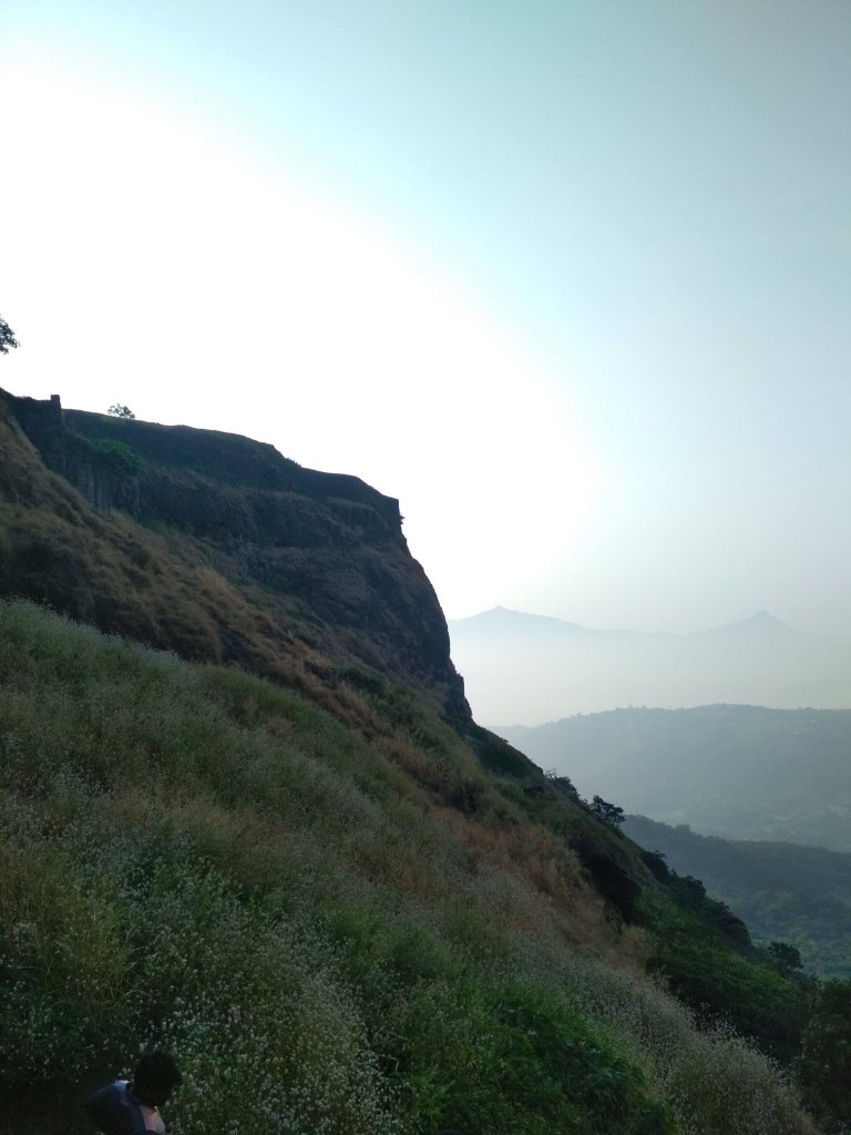
Trekking route

History
Lohagad has a long history with several dynasties occupying it at different periods of time Satavahanas, Chalukyas, Rashtrakutas, Yadavas, Bahamanis, Nizam’s, Mughals and Marathas. Chhatrapati Shivaji Maharaj captured it in 1648AD but he was forced to surrender it to the Mughals in 1655 AD by the Treaty of Purandar. Chhatrapati Shivaji Maharaj recaptured the fort in 1670 AD and used it for keeping his treasury. This fort was used to keep the loot from Surat. Later in Peshwa time Nana Phadnavis used this fort living for sometime and built several structures in the fort such as a big tank and a step-well. The lohagad fort also has caves on it’s south side facing Lohagadwadi.

Geography and Climate
Lohagad is part of the Western Ghats. It rises to an elevation of 1,033m (3,389ft) above sea level, and is located to the south-west of the Visapur fort. The range divides the basins of the Indrayani River and Pavana Lake. Lohagad overlooks the Pavana reservoirs, located to the south of the mountain. The hills extends to the North West to a fortified spur, called Vinchukada (scorpion’s tail) because to its resembling shape. The four large gates of Lohagad are still in good condition and reasonably intact. During the monsoon, the top of the fort is covered with mist and clouds and becomes particularly wet with growing moss. The roads and trails leading to the hill are quite slippery at this time of the year and precautions are necessary to be taken while venturing the routes.
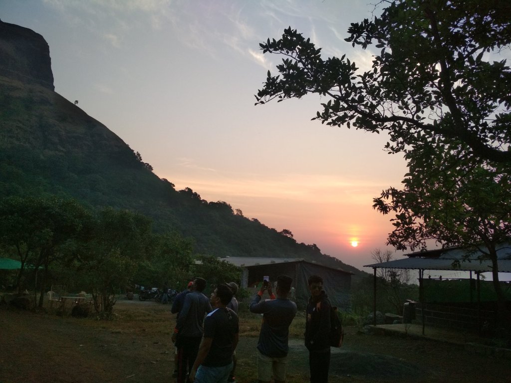
Sunrise

Accessibility
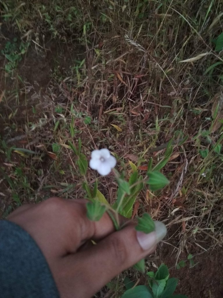
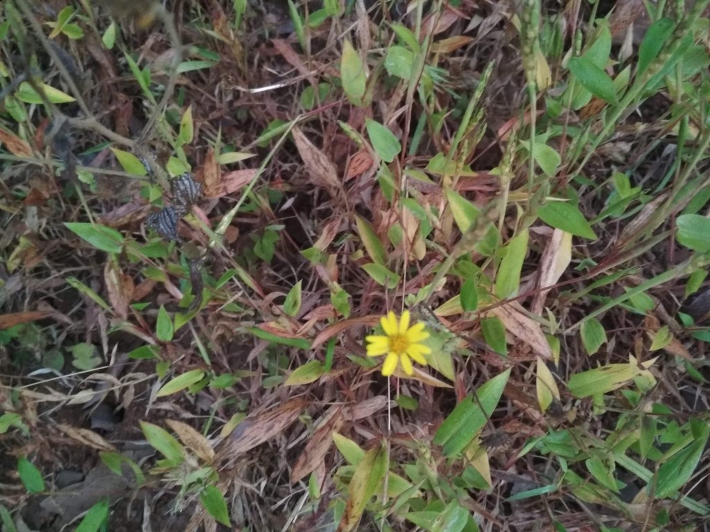
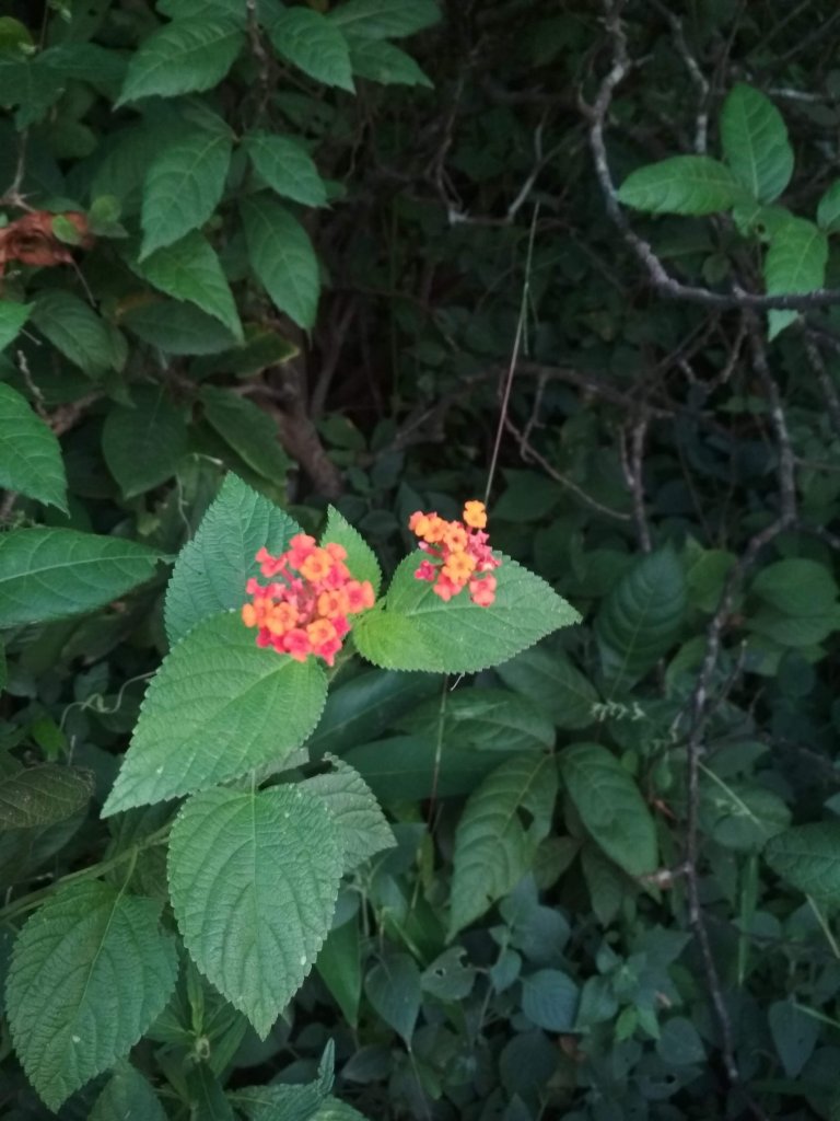
Lohagad fort can be accessed by various modes of travel. The nearest airport is the Pune International Airport. The proposed Navi Mumbai International Airport will serve as the nearest airport in the coming future. The nearest train station is Malavli, which can be accessed by suburban trains between Lonavala and Pune. The nearest major train station is Lonavla, on the Mumbai-Pune railway line. Lohagad is connected by the Mumbai-Pune Highway and can also be accessed from Paid via Kolvan and Dudhiware Khind for all vehicles. People can hike all the way to the fort. Bhaja caves is on the way to Lohagad if a small diversion is taken. This walk is particular favourite for trekkers, especially in the monsoon season. It is a simple, very scenic and pleasant trek and the distance from Malavli and Lohagad can be covered in around 2 hrs. A tar road exists all the way to the Top from Malavli station and one can hire a tempo or cap to the top. The best season to visit is monsoons it is absolutely safe and many vendors selling onion fritters and lemonade are present by the roadside. One can also cut across the hills as well.The fort has around 350 steps from the base, and it is not advisable to take a personal car as the road is single lane, sleep & very Bad. Variety of Insects can also be spotted in these hills.
Nearby attractions

  • Bhaja caves – 2km (1.2mi) from Malavli, once home to Buddhist monks.
  • Karla Caves
  • Lonavla 20km (12mi), famous and scenic hill station.
  • Aamby Valley City – 22km (14mi) from Lonavala.
  • Visapur

Bhaja caves
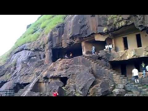
It is a group of 22 rock cut caves dating back to the 2nd century BC located in the city of Pune, India. The caves are 400 feet above the village of Bhaja, on an important ancient trade route running from the Arebian sea eastward into the Deccan plateau (the division between North India and South India). The inscription and the cave temple is protected as a Monument of National importance, by the Archaeological Survey of India per Notification no 2407-A.
Bhaja Caves

Karla Caves
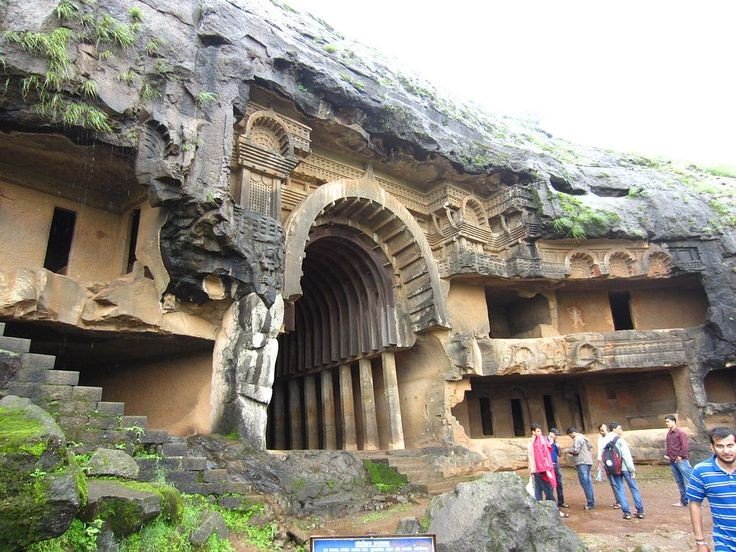
It is complex of ancient Buddhist Indian rock-cut caves at Karli near Lonavla, Maharashtra. It is just 10.9 kilometers away from Lonavala. Other caves in the area are Bhaja Caves, Patan Buddhist cave, Bedse caves and Nashik caves. The shrines were developed over the period from the 2nd century BCE to the 5th century CE. The oldest of the cave shrines is believed to date back to 160 BCE. having arisen near a major ancient trade route, running eastward from the Arabian into the Deccan.
Karla Caves

Lonavala
Refer to Lonavla blog in my explore menu.

Aamby Valley City
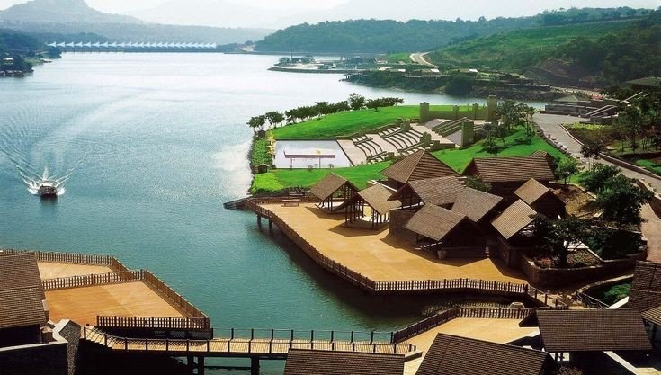
It is a township developed by the Sahara India Pariwar in Pune District in the Indian state of Maharashtra. It is about 23km (14mi) from Lonavala, 87km (54mi) from the city of Pune and 120km (75mi) from the city Mumbai. The township is connected by road of Mahabaleshwer. City is spread over 10,600 acres (4300ha) of hilly terrain. 3 large Man made lakes have been created by constructing dams. The largest lake is 1.5km in length, it also boasts of a PGA 18 hole golf course. This city was so designed and master planned by Gruen-Bobby Mukherji and Associates in the year 2003.
Aamby Valley City

Visapur Fort
It is at a Higher altitudes than Lohagad fort, water tanks, old houses, arch, waterfalls, temples are on the Sahyadri Fort. There are two buildings which are Roofless now, are government offices from the past. A stone built home at Visapur fort called Peshwas Wada popularly. Lord Hanuman carving seen the fort, there are many temples dedicated to him at the fort. Visapur is an ideal trekking destination near Mumbai, Pune, Lonavla.
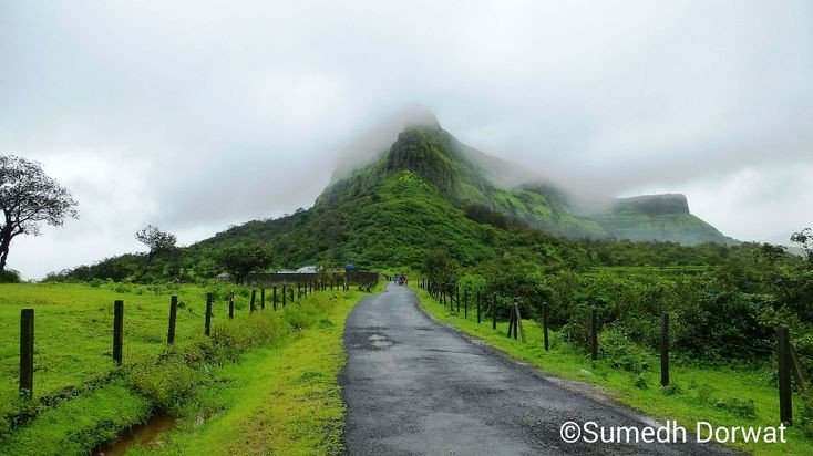
Visapur fort

Below are the Clicked images at the top of the Fort with details
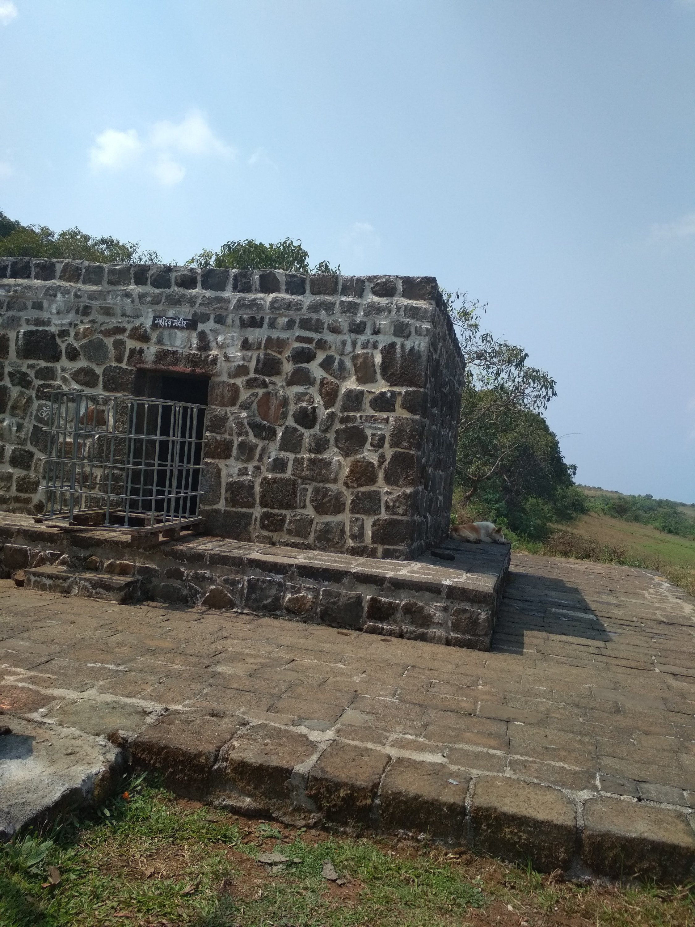
Shiva Temple built from black rock one of the toughest rocks in the world.
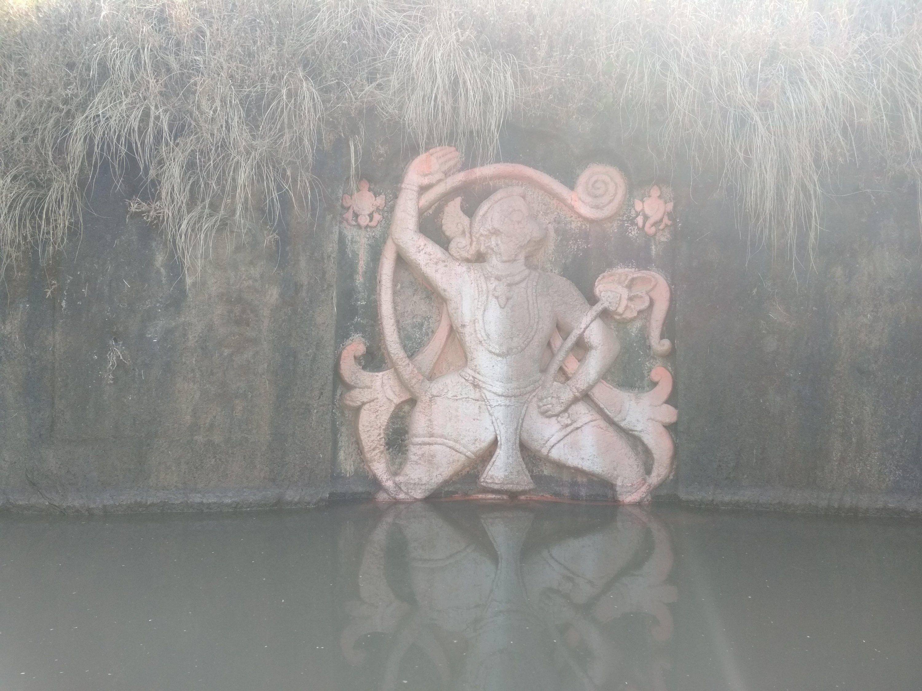
A statue of Lord Hanuman sculpted in between in the water tank
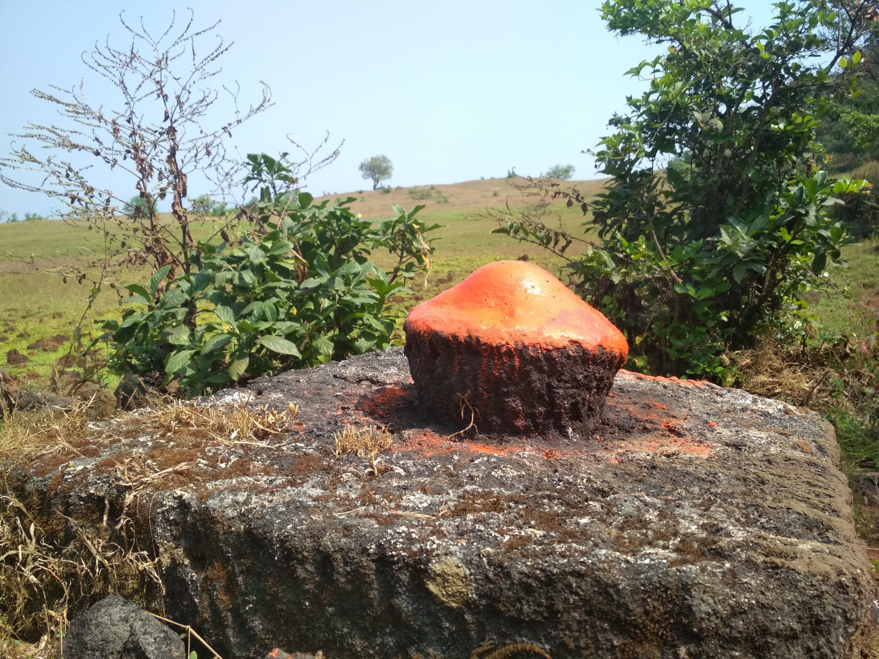
Sculpted rock as Shiv Ling built in between the walking path.
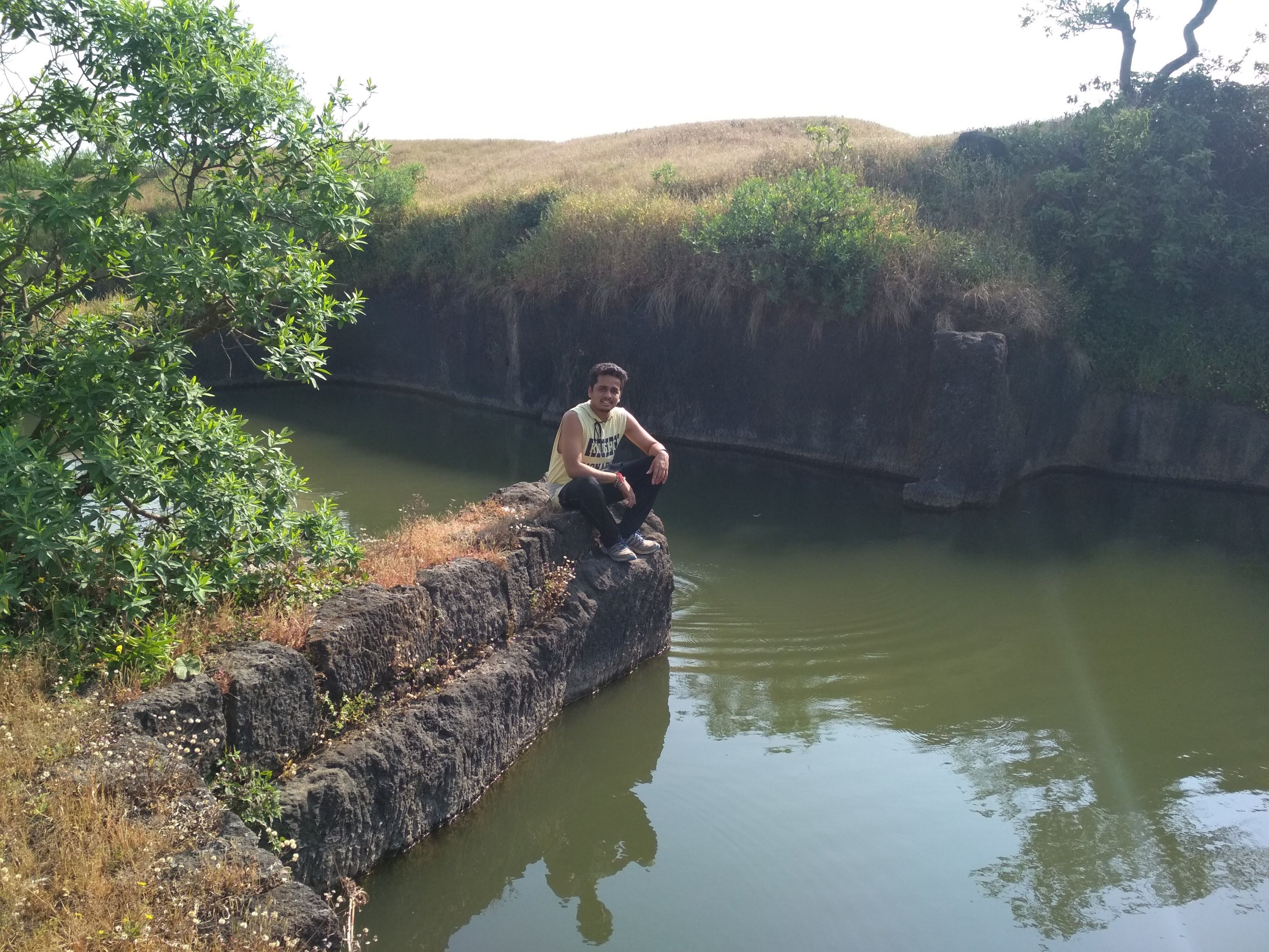
Broken bridge, people used to travel from one end to another from above the stored water.
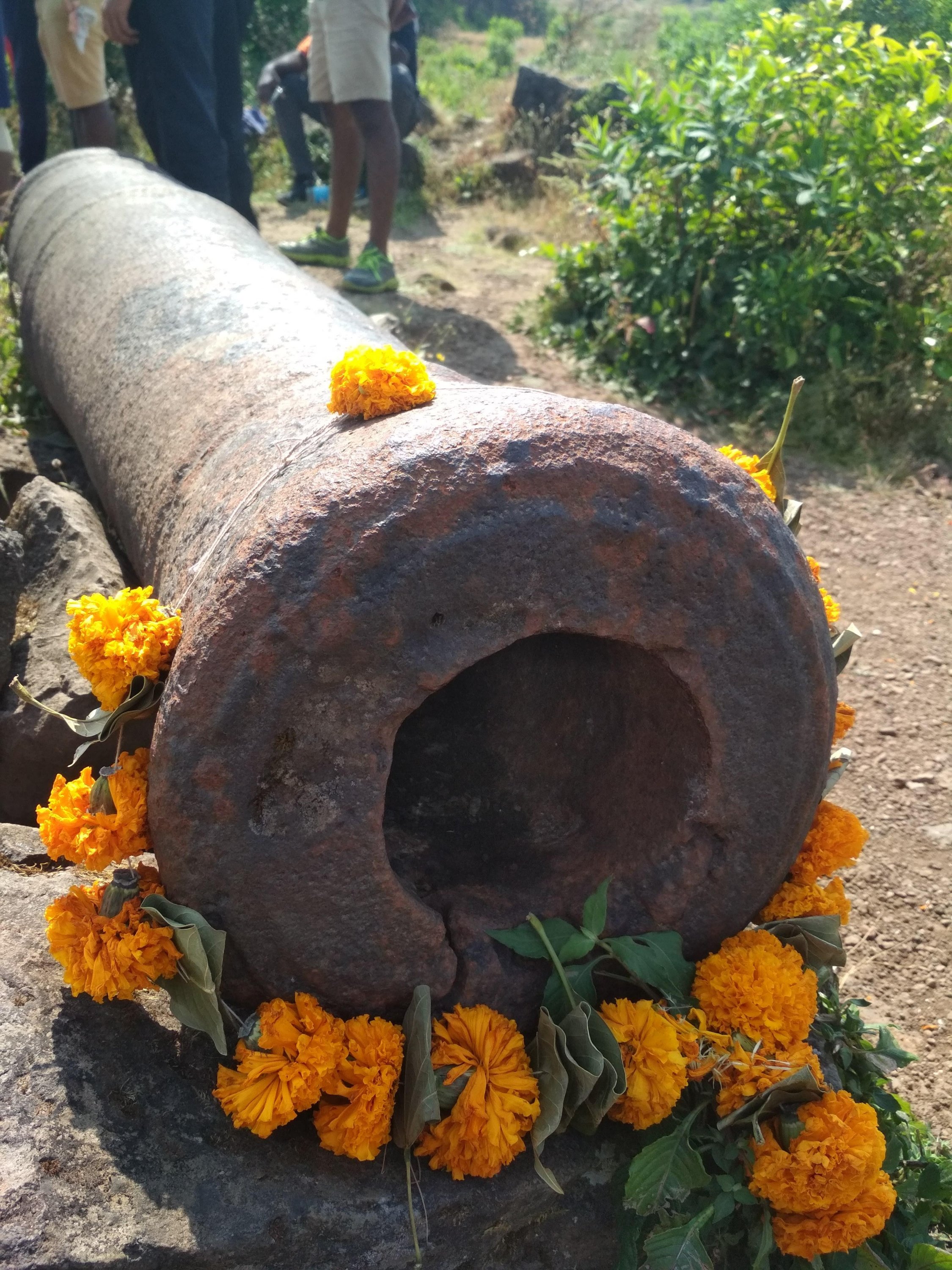
Cannon which been used by Great Marathas during wars, Weighing Almost more than a one ton approx.
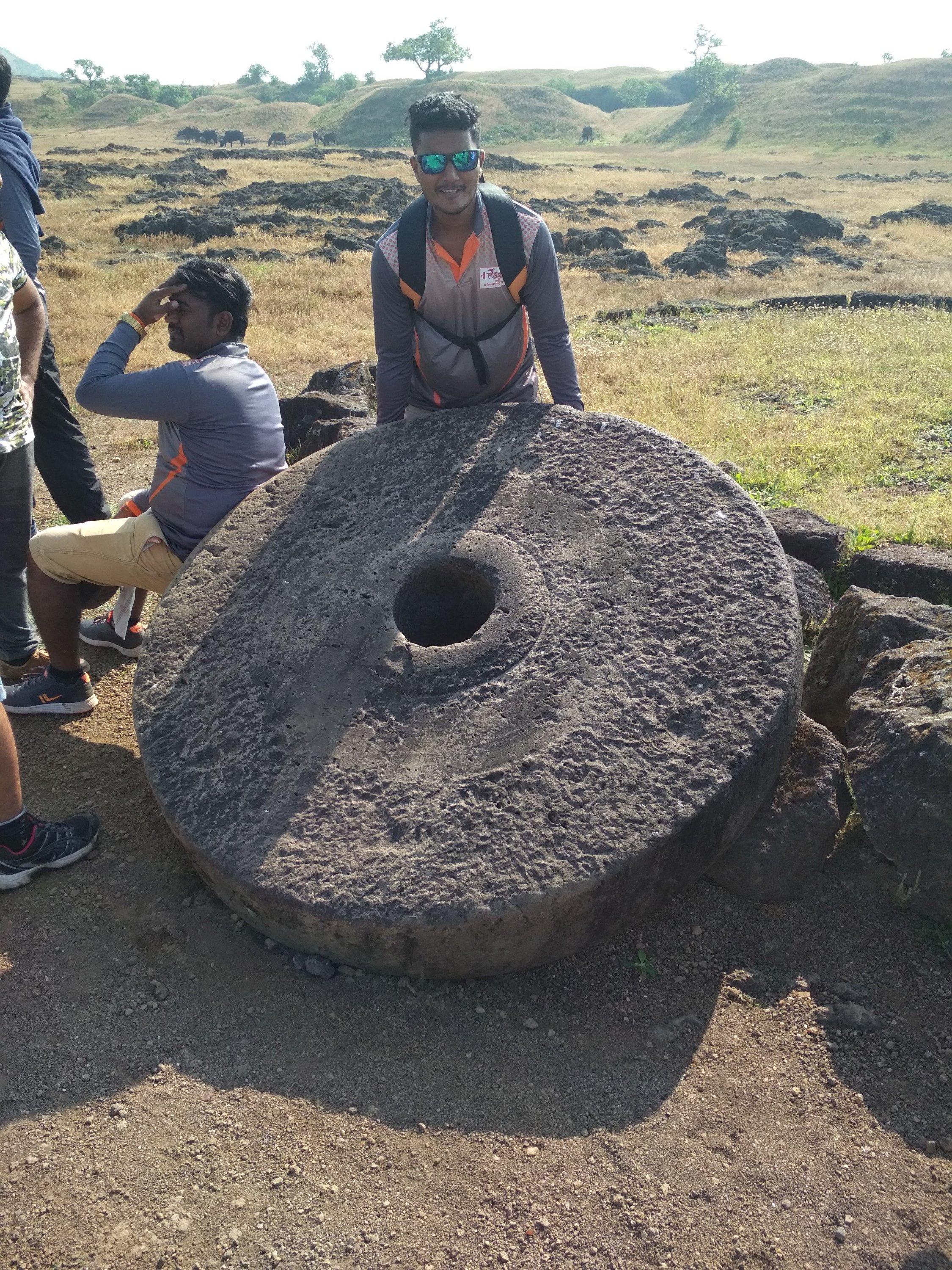
Roller not in a normal size as compared to household one
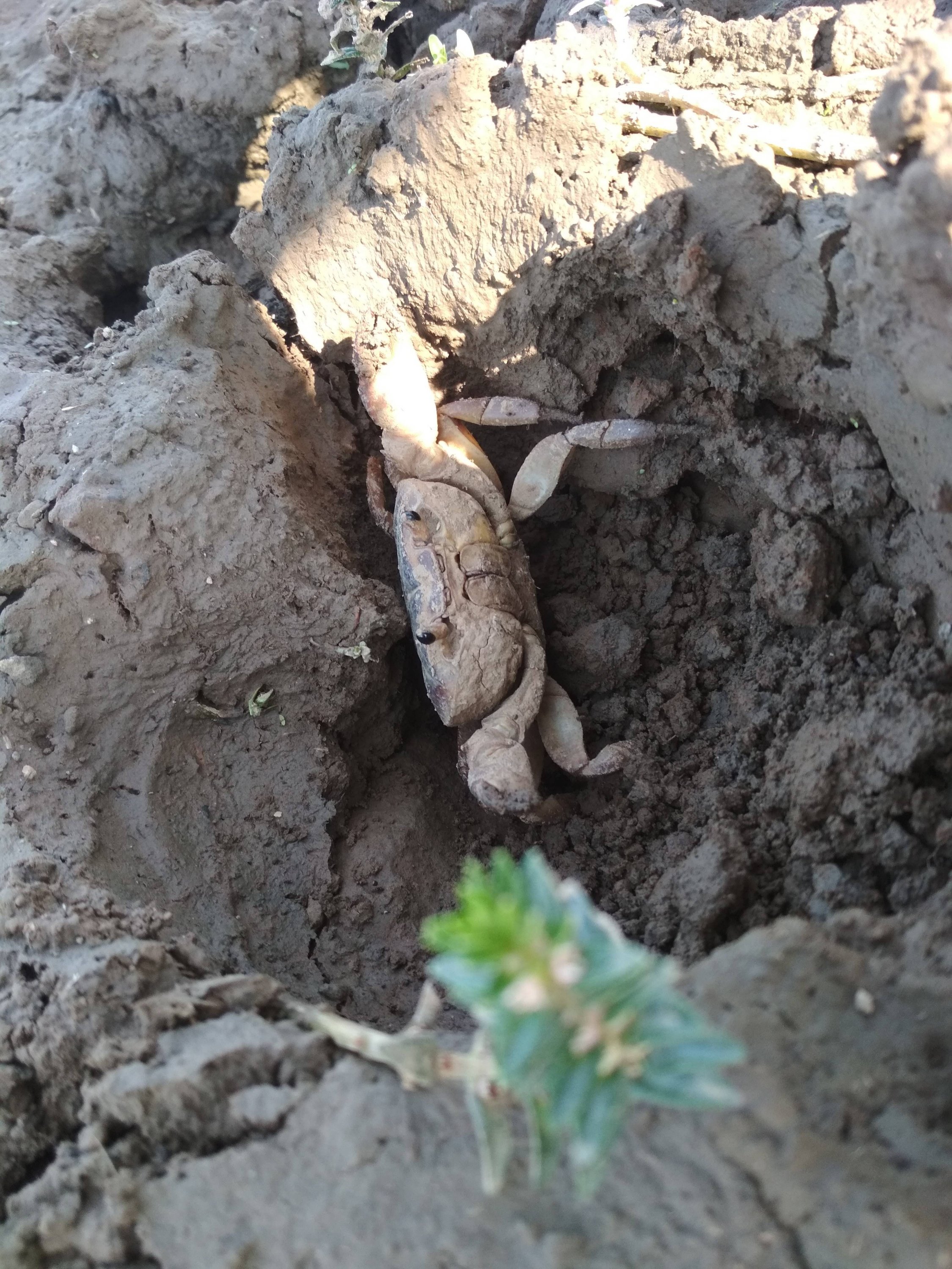
Mud crab specially found inside the Fort territory still exists.
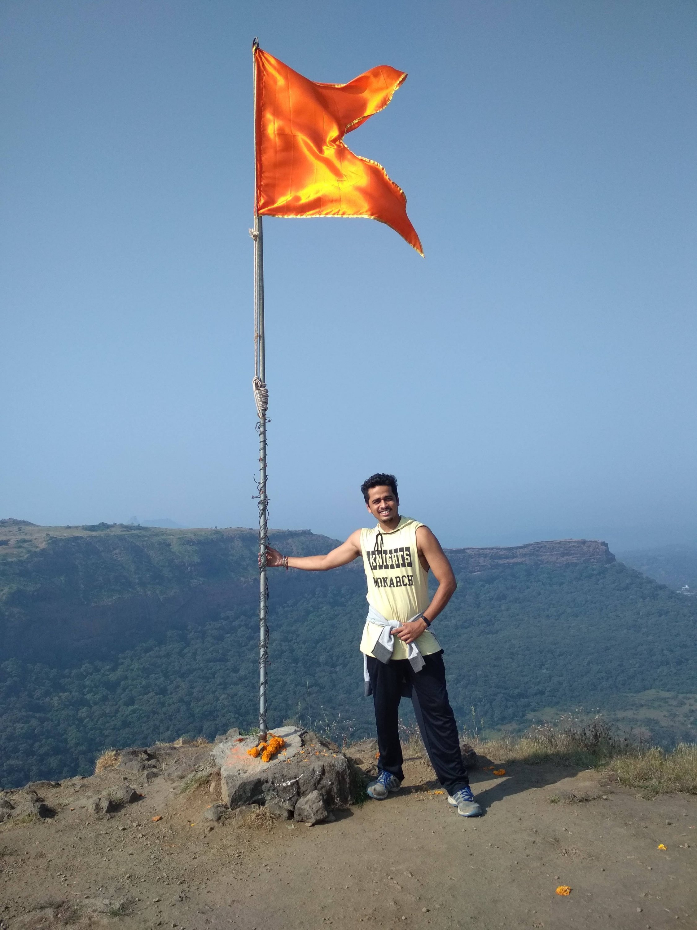
Highest point at the Fort, holding the saffron colour flag, which is dedicated to GREAT MARATHA WARRIORS.

Thanks for watching and reading if you like my blog please Like share comment and follow for more Content like this.

MAHABALESHWER

Overview


MAHABALESHWER is a small town and a municipal council in Data district in the Indian state of Maharashtra. It is a place of pilgrimage for Hindus because the Krishna river has its origin here. The British colonial rulers developed the town as a hill station and served as the summer Capital of Bombay Presidency during the British Raj.

  • Elevation:- 1,353m (4439ft)
  • Area:- 137.2km sq
  • Sex ratio:- 90 females/ 100males
  • District:- Satara
  • Population:- 12,737 (2011)

Geography


Mahabaleshwer is located at 17.9237°N 73.6586°E. It has an elevation of 1,353 meters (4439ft). Located about 120km (75mi) southwest of Pune and 285km (177mi) from Mumbai, Mahabaleshwer is a vast plateau measuring 150km (58sqmi) bound by valleys on all sides. It reaches a height of 1,439m (4,721ft) at its heighest peak above sea level, known as Wilson/Sunrise point. Mahabaleshwer comprises three villages : Malcolm peth, Old “Kshetra” Mahabaleshwer and part of the Sindhola village. Mahabaleshwer is the source of Krishna River that flows across Maharashtra, Karnataka, Telangana, and Andhra Pradesh. The legendary source of the river is a spout from the mouth of a statue of a cow in the ancient Temple of Mahadev in Old Mahabaleshwer.

History


On the outskirts of Mahabaleshwer, towards Panchgani. The first historical mention of Mahabaleshwer dates back to year 1215 when the King Singhan of Deogiri visited Old Mahabaleshwer. He built a small temple and water tank at the source of Krishna river. Around 1350 a Brahmin dynasty ruled this area. In the middle of the 16th century the Maratha Family of Chandarao More defeated the Brahmin dynasty and became rulers of Javli and Mahabaleshwer, during which Old Mahabaleshwer temple was rebuilt.

In 1656, the founder of Maratha empire Chhatrapati Shivaji Maharaj under controversial circumstances, killed Chandrarao More, a fellow Maratha feudatory of Bijapur, and seized the valley of Javali, near Mahabaleshwer, from him. Around that time Chhatrapati Shivaji Maharaj also built a fort near Mahabaleshwer called PratapGad. The fort remains in the hands of Shivaji’s Descendants to this day.

Transport

By Road:- Mahabaleshwer is 32km from Wai. It is 260km from Mumbai, the state capital. The nearest major city in Satara is 45km and it is 120km from Pune. Mahabaleshwer is connected by the National Highway 4. Bus services by State-run MSRTC and Private organizations connect it to Pune, Mumbai, Sangli and Satara.

Rail

Nearest railroad is Satara 60km, nearby major railway junctions include Pune (120km), and Niraj (170km). State run bus services are available in these locations to Mahabaleshwer. Railway station Diwan Kharvati on Konkan Railway near Khed gives route of 60km via Poladpur to Mahabaleshwer.

Airway

The nearest Airport is Pune international Airport, serving the city of Pune, 120km from Mahabaleshwer.

Sunset at Mahabaleshwer
Lake near Mahabaleshwer

Places to visit

  1. Mahabaleshwer Temple:- Panchaganga temple in Old Mahabaleshwer 1850s. In old Mahabaleshwer 7km from Mahabaleshwer there are many tourists point and 5 temples to see, with examples of old Indian Architecture. There are also natural view points, some of them named by the 19th century British colonial rulers.
  2. Krishnabai temple:- Behind Panchaganga temple, there is a small trail that leads to Krishna Bai temple where the Krishna river is worshipped. It is built on the hilltop overlooking the Krishna valley and was built in 1888 by a ruler of Ratnagiri on the Konkan coast. The temple has a Shiva Lingam and a beautiful statue of Krishna. A small stream of the river flowing from the cow-face (Gomukh) falls on a Kinda or water tank. Stone carved columns and ceilings are the special characteristics of this Temple. This old temple has gathered moss and is in ruins. It is not visited much by tourists and is isolated. But it provides a most exquisite view of the river Krishna.
  3. Monkey Point:- Named because of the natural sculpture of the stones which looks like three Monkeys sitting beside each other and portraying 3 monkeys of Gandhiji. Nestled deep in the Valley one can figure out from the outline of a big stone a natural cut out it give an effect of 3 Monkey sitting next to each other portraying the Three Wise Monkeys. They point is on route to Arthur’s Seat.
  4. Arthur Lake:- This geographical point is named after Officer Sir Arthur Market (1806-1888) who frequented the spot to gaze at the Savitri River, where he lost his wife and children in a tragic ferry mishap.
  5. Vienna Lake:- Mahabaleshwer is Holiday place, Honeymoon spot and a pilgrimage site for people. Boats on the Venna lake in Mahabaleshwer. The Venna lake is one of the tourist attractions of Mahabaleshwer. The lake is surrounded by trees. There are Hotels from budget hotels to 3 star. Some Hotels are also near Lakes view or in the market.
  6. Kate Point:- It is located to the east of Mahabaleshwer and is famous for its view of two reservoirs, balakwadi and Dhom. The point is around 1280m high.
  7. Needle Holepoint/ Elephant point:- Needle hole point is located near Kate’s point. One can see a natural rock formation with a hole in between, thus given the name Needle hole. The point is also famous for the view of Deccan traps, which look like an elephant’s trunk.
  8. Wilson point:- Named after Sir Leslie Wilson, the Governor of Bombay from 1923 to 1926. Wilson Point is the highest point in Mahabaleshwer at 1439m. Known as Sindola Hill during the colonial rule, Wilson point is the only location in Mahabaleshwer where both sunrise and sunset can be seen. It offers a spectacular glance of Mahabaleshwer in all directions. It is located behind the Mahabaleshwer-Medha road at 1.5km from Mahabaleshwer city.
  9. PratapGad:- it is a fort near Mahabaleshwer built by Chhatrapati Shivaji Maharaj. It is the site of the encounter between Shivaji and Bijapur general. Afzal khan where the latter was defeated and killed by Chhatrapati Shivaji Maharaj.
  10. Lingmala waterfall:- This waterfalls is located near Mahabaleshwer. The water here falls from the height of approximately 600 feet. The water of Lingamala waterfalls cascades into the Venna Lake. The waterfalls are divided by outward projecting rocks into multiples tiers.
KRISHNABAI temple
PratapGad fort
Lingmala waterfall
Elephant point
Monkey point
Strawberry

Also famous for the berry Climate of the area is suitable for cultivation of strawberries, this place contributes to about 85% of the total production in the country. It also received the geographical indicator tag in 2010 Strawberry is personally my favourite fruit.

If you like my blog please like comment share and Follow

ROAD TRIP TO MATHERAN

That’s me

The only best way to Travel on the hill stations is by road, there’s no other way that can be equally compared advising with my personal experience.

How to reach:- If you leave in Mumbai it take 2hr to reach at top of the mountain place which is around 95km long from my place, roads are simple and easy the best way to take help is of Google map but if you are frequent traveller like me then there would be no difficulty, petrol will cost you around 500rs for bike and for car it could be around 1000rs.

Other than roadway is railway, Neral is the closest railway station to Matheran. Situated to Mumbai-Pune line it is just 21km away from Matheran you can also board the Matheran hill railway from Neral which is one of the 6 mountain railways in India, nearest airport to Matheran is Pune, one can also take a cab or a bus from nearby towns to a place close to Matheran (3km) and take horse-rides or walk or Man pulled rickshaws to reach our destination.(Automobiles are not allowed in Matheran and hence one has to use these pollution free methods.

Matheran Toy train

NOTE: I would not recommend to take horse rides because that’s animal abuse, Make sure before leaving for the journey Kindly Check your vehicle condition like Engine oil, break oil, Clutch wire, break wire, horn and Tyres air pressure.

My Ride

PLaces explored during ride

One of the reasons to choose road trip is that you will love to watch the beautiful nature side by side while you travel, unimaginable places can be explored fortunately which happens mostly with me, during my trip as I traveled many times in that journey many pictures have be clicked. It’s feels amazing to see such things in real life as compared to reel life

Places of Attraction

  • Louisa point:- Louisa point is one of the most famous viewpoints in Matheran, it offers two different views from the top, visit Louisa point is on a clear day to enjoy the spectacular view of the city and the remains of Prabal and Vishalgad fort, the best time to visit is during sunset, it is located 1.5km away from the main market area and is easily reachable on foot. Tips:- Beware of Monkeys, do not carry any food items as they might try to snatch it, do not support animal abuse like horse rides.
Louisa point
  • Charlotte Lake:- Also known as Sharlott lake, It is one of the most spectacular attractions of Matheran, it is an ideal quick retreat for those who seek silence in the lap of nature and a perfect spot for the Campers and picnickers. Set amidst a densely populated forest, birdwatching is a popular activity here. People visit here for sunrise and sunset view of Echo point. Tips:- Since the lake serves as a source of drinking water for Matheran don’t try to take bath or wash anything in the lake it is forbidden and also beware of Monkeys and their snatchings.
Small part of lake

Trekking routes:- Matheran has various trekking routes. All routes are easy from climbing difficulty point of view.

  • Sunset point is the route from Dodhani village to Sunset point. This is the most popular route for trekkers. Dodhani village is about 45 minutes by State Transport bus from Panvel.
  • Garbett point Route is the route that starts from Sagachiwadi a small tribal village near to Dhom dam. Garbett point is the least visited point in Matheran because it is very far away from market compared to other points. Mostly there is always no one at Garbett point even during peak season. The vast green stretch of Garbett plateau is major attractions during Monsoon season.
  • Rambaug Point Route is a small and popular point near One tree hill point. This route goes from Rambaug point to a small village called Pokharwadi near Chowk village. The route passes through a waterfall during rainy season.
  • One tree hill this route starts from Ambewadi village. Ambewadi is near Pokharwadi village, where route starts from Rambaug point. There is a view of Morbe Dams backwater while going through Rambaug and One Tree hill route.
  • Vikatgad route is the most difficult one. This route to Garbett point is the next more popular route. All the routes require 2-3 hrs climb to reach Matheran. The route of Rambaug point and One Tree Hill are usually not taken by any trekkers nowadays.

Food
After so much of long and hard way of trek body requires plenty of energy source. There are all kinds of restaurant in Matheran serving various cuisines. Most hotels offer packages including all meals. Try the Gujarati Thali. Or the Maharashtra style Vada-Pav (Indian burger) which is available at the various points. Also try Chikki which is available in different flavours.

Sleep During the peak season, when it is very busy, prices are often as high as four times the off season winter price. Be ready to shell out minimum of INR 2000 for modest Non-Ac double bed room on a weekend. As it is a popular weekend trip from Mumbai, mid week is less full so you should be able to negotiate better prices, and there are various hotels down the paths away from the central buildings. It’s always better to stay in hotels in the hotels in the Market as you can roam around there once it gets dark. In far off hotels you would get locked up in the room as it won’t be advisable to venture out in the dark in forest. Better don’t book any rooms from the agents who would surround you at Novel Station. There are many rooms( hotels, cottage and resorts) up at Matheran market and it is better to actually check the rooms and then deal directly with the owners as this can save money as well as disappointed if being dubbed into a poorly maintained sub standard room.

Below are few more information about Matheran

List of trees growing in Matheran

Albizzia chinensis (Udal, Kajav)


actinodaphne angustifolia (Pisa)


Sugran Tree


Chambel tree


Bambusa Vulgaris (kalak)

Wildlife:- The town has a large monkey population, including bonnet macaques and Hanuman langurs. Domesticated horses for riding are also in large numbers and are one of the symbols of Matheran. Inside the forest animals like barking deer, Malabar giant squirrel, fox, wild boar, mongoose may be found, but this animals are less in numbers as compared to Monkeys and usually do not venture where humans are present. There have been reports of leopard sighting in Matheran few times in last decades but due to dense forests in valleys surrounding Matheran leopards who are on the roam may climb Matheran, not a single report have been found of leopard attack in Matheran.

Leopard
Fox
Barking deer
Malabar giant squirrel
Mongoose
Wild boar

Thanks for watching and reading, if you liked my blog please Like comment share and follow